Back 40 Trailheads: Where to Park and Start the 22-Mile Loop
The Back 40 trailhead you pick decides your whole ride, because the Back 40 in Bella Vista has no single start. The City of Bella Vista lists eight places to park around the loop. For a first full lap of the 22-mile loop, start at the Blowing Springs trailhead. For the middle of the network, park at the Lake Ann trailhead. For a short, easy ride, start at Metfield.
Back 40 trailheads at a glance
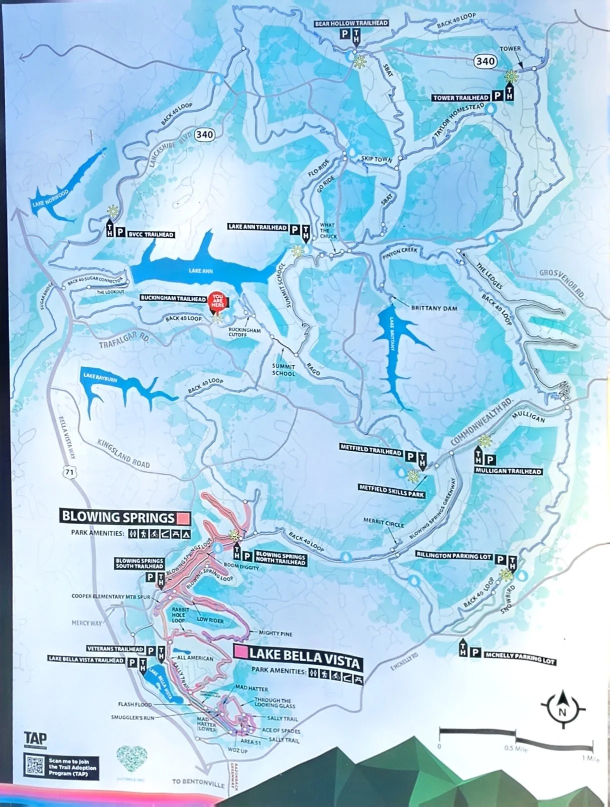
All directions start from US-71 northbound, as the City of Bella Vista lists them.
Blowing Springs North Trailhead
How to get there: Right on Mercy Way (becomes Blowing Springs Road), 0.5 mile, trailhead on the right
Best for: Full 22-mile loop, Gear Garden after the ride, pairing with Wonderland
Lake Ann Trailhead
How to get there: Right on Trafalgar Road for 3.8 miles, left on Castleford Drive, trailhead on the left after ¼ mile (Castleford Dr and Wem Ln)
Best for: The middle of the network: Summit School, Rago, Flo Ride
Metfield Skills Park
How to get there: Right on Trafalgar Road for 2.4 miles, right on Commonwealth Road for 0.6 mile, parking on the right
Best for: Shorter rides, Mulligan, Rago, the paved path
Metfield Cart Barn (Golf Course Parking Lot)
How to get there: Right on Trafalgar Road for 2.4 miles, right on Commonwealth Road for 1.1 miles, parking on the right
Best for: Overflow for Metfield
Buckingham Trailhead
How to get there: Right on Trafalgar Road for 1.2 miles, left on Buckingham Drive, trailhead on the right
Best for: Summit School, Rago, Pinion Creek Falls
Bella Vista Community Church (Parking Lot)
How to get there: Exit 98 (Lancashire Blvd), right for 0.6 mile
Best for: Trailhead on the left, Northwest side of the loop, Pinion Creek Falls, Lookout
Bear Hollow Trailhead
How to get there: Exit 98, right on Lancashire for 3.2 miles, left on Gainsford Drive, trailhead on the left after 350 feet
Best for: North side of the loop, Flo Ride and SBAT
Snowbird Trailhead
How to get there: Right onto McNelly Road for 2.1 Miles to Snowbird Trailhead Parking lot
Best for: Snowbird, Back 40 Loop
Trail system: Back 40, Bella Vista
Loop length: 22-mile loop, with more singletrack crossing the middle
Wet-weather trail: Yes. Back 40 is on the official wet-weather list.
Hours: The city lists the trails as open 5 a.m. to 10 p.m. daily.
How Back 40 parking works
Think of the Back 40 like a wheel. The 22-mile loop is the rim, and trails like Rago, Mulligan, Pinyon Creek, SBAT, and Flo Ride cut across the middle like spokes. Every trailhead above sits on the rim or a spoke, so you can ride the full loop from any of them and use the spokes to shorten it.
The trailheads split into three groups:
South end (Blowing Springs & Snowbird): closest to Bentonville and the easiest to find.
Trafalgar Road side (Buckingham, Metfield, Lake Ann): the middle of the network, where most of the cross-trails meet.
Lancashire Boulevard side (Bella Vista Community Church, Bear Hollow, Tower): the north and west edges of the loop.
Blowing Springs: the start for the full loop
Blowing Springs is the best Back 40 trailhead for a first full lap. It's the southernmost start and the closest to Bentonville. From US-71 northbound, turn east on Mercy Way. It becomes Blowing Springs Road after the stop sign, and the trailhead is about half a mile up on the right.
Park in the front lot before the RV Park gatehouse. Ride the South section of the Blowing Springs loop and it drops you at the Back 40 junction at the back of the park. Weekend mornings fill up, especially when the Gear Garden is open.
The Gear Garden is the reason to finish here. It has picnic tables and a shallow spring to cool off in, and food trucks and a beer garden open later in the day. Our Blowing Springs camping guide [LINK NEEDED: Blowing Springs Park Camping and RV Guide blog post] covers staying right at the trailhead, and the RV and campgrounds page has more options.
In Brad's words from our Back 40 trail guide: "Pick a sensible start point like near the Blowing Springs RV Park gear garden parking lot."
Lake Ann: the middle of the network
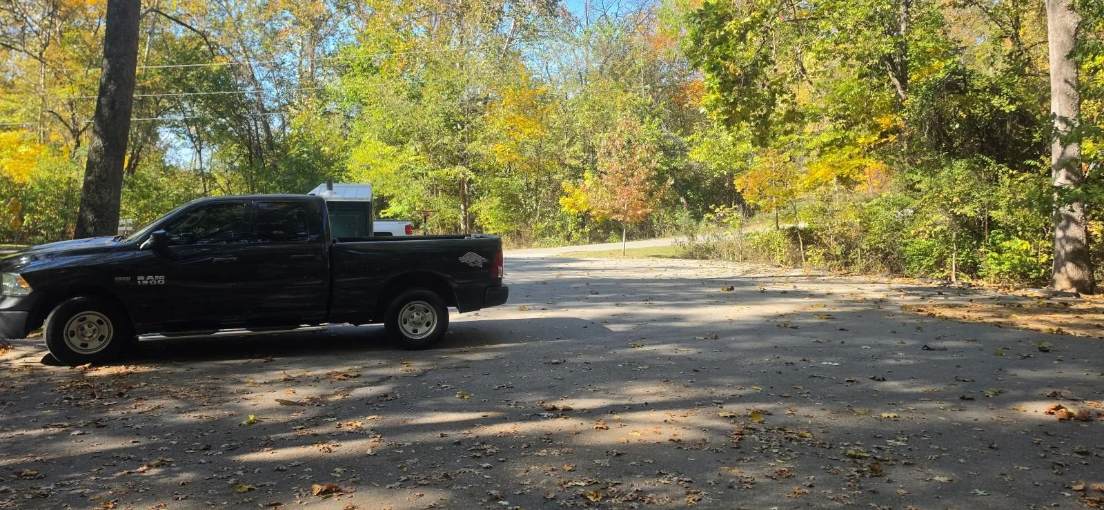
Lake Ann is the trailhead to pick if you want to build your own route instead of riding the whole loop. The Arkansas Cycling Guide calls it the epicenter of the system. Take Trafalgar Road east 3.8 miles from US-71, turn left on Castleford Drive, and the trailhead is on the left a quarter mile in, at Castleford Drive and Wem Lane.
From Lake Ann you can reach Summit School, Rago, and Flo Ride without much road riding. Summit School is rated expert by the city, so check the trail sign before you drop in.
Metfield: the short-ride start
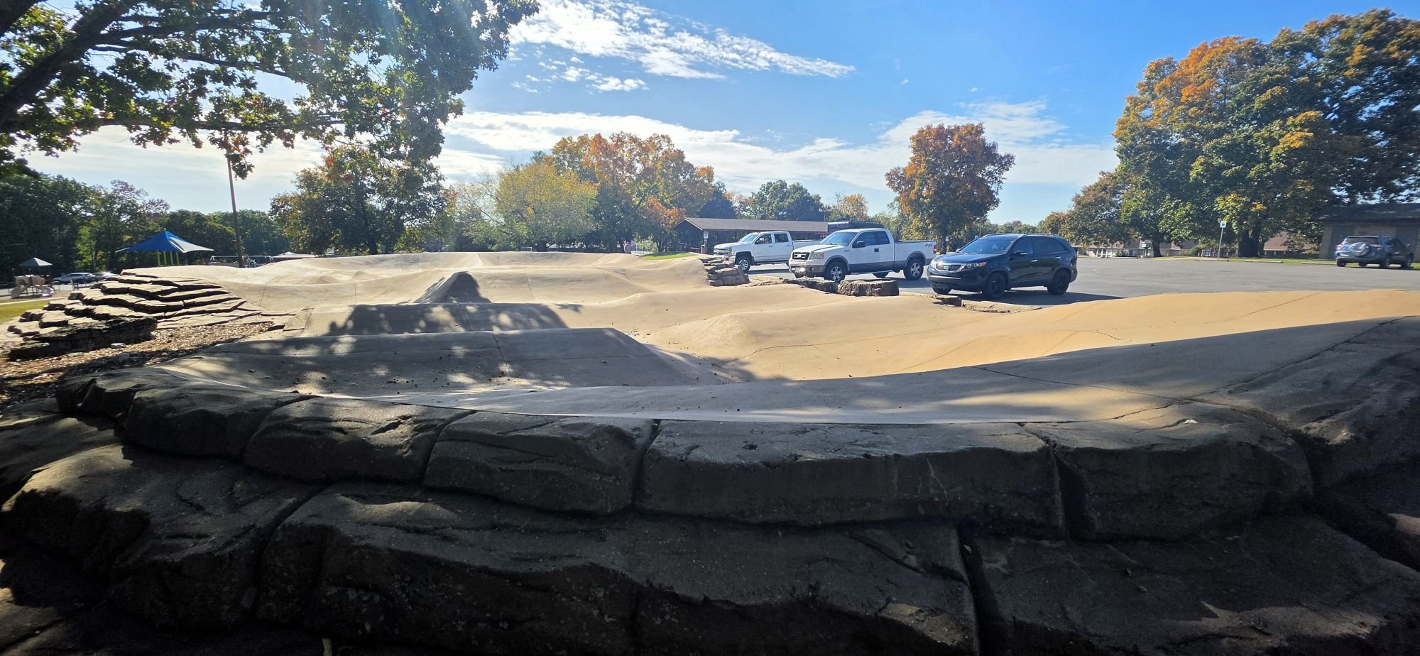
Metfield is the best start for newer riders and short rides. The city lists two lots off Commonwealth Road: the Metfield Pump Track lot 0.6 mile in, and the Metfield Cart Barn lot at 1.1 miles. Both are at the Metfield Golf Complex.
Mulligan, the only trail the city rates beginner on the Back 40, is close by, and Rago connects you to the loop. A paved path also runs from Metfield toward Blowing Springs, which is an easier way in for kids.
One popular route from here: ride Rago (or the paved path) to the Back 40 loop, then take Summit School, Pinion Creek, Flo Ride, Go Ride, SBAT, and Taylor Homestead before heading back. Take Mulligan back to the lot if you want to cut it short.
Buckingham: quick access off Trafalgar
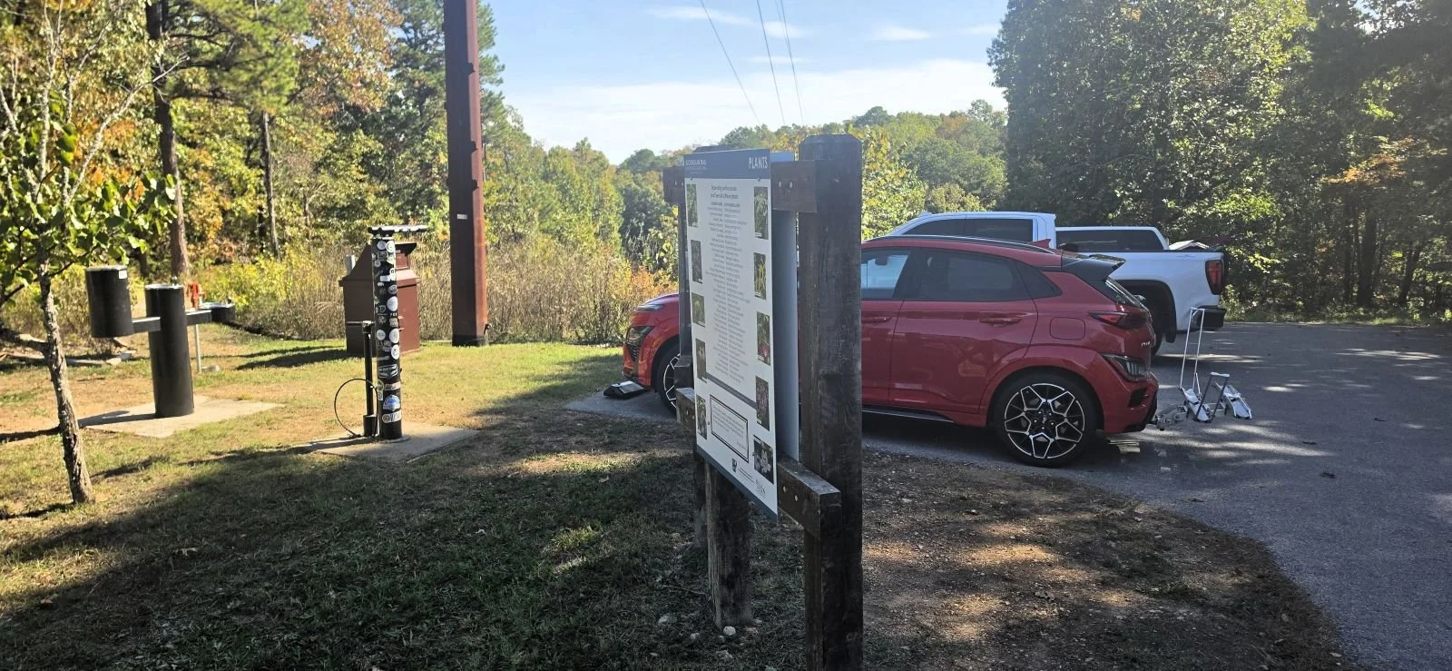
Buckingham is the first trailhead you reach on Trafalgar Road, 1.2 miles east of US-71. Turn left on Buckingham Drive and the trailhead is on the right. It was one of the four original Back 40 trailheads when the first section opened in 2016. This is one of the smaller parking lots choices.
It's a good start for a mid-length ride to Summit School, Rago, or Pinion Creek Falls.
The Lancashire Boulevard trailheads put you on the north and west sides of the loop.
Bella Vista Community Church is 0.6 mile east on Lancashire from exit 98. It's the shortest drive off the highway on the north side, and a good start for riding to Pinion Creek Falls and Lookout.
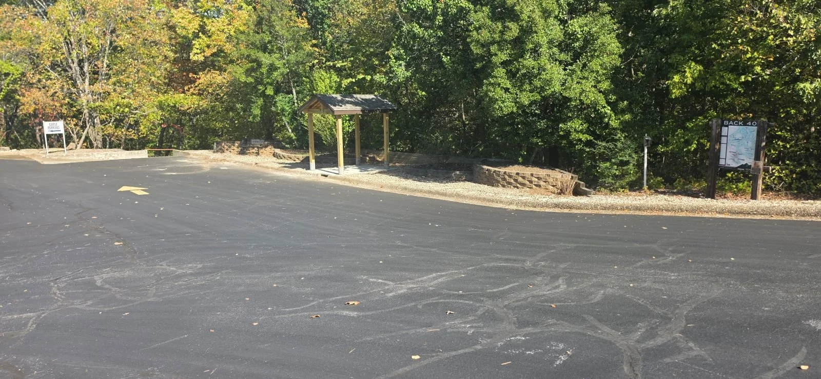
Bear Hollow trailhead is at Gainsford Drive and Gosforth Lane, 3.2 miles east on Lancashire. It puts you on the north side of the loop close to Flo Ride and SBAT. There is a road that will take you to the Bear Hollow Cave which has a large metal grate covering the entrance.
There is a small parking area right by Pinion Creek Falls, I did not include it above as it is more parking on the side of the road than an actual parking lot. It is a good place to start for riding parts of both the Back 40 and Little Sugar in one outing. The Back 40 connects to Little Sugar by a 400-foot bridge over Little Sugar Creek.
Which Back 40 trailhead should you pick?
First time: full 22-mile loop: Blowing Springs.
Build your own route: Lake Ann.
Short ride or newer riders: Metfield, with Mulligan and the paved path.
Riding Wonderland the same day: Blowing Springs.
Quieter start: Bear Hollow or Tower. This may also be the furthest from Bentonville option.
Rain overnight: Back 40, Blowing Springs, and Wonderland are all on the wet-weather list. Check the Trail Conditions page first.
Before you start the loop
Plan your exit: The loop is well marked, but it's easy to blow past a turn when the riding is good. Download a map on Trailforks or All trails before you leave the lot. The different trailheads have a large map you can use for reference. Snap a quick pic for future reference.
Water. There are water fountains along the Back 40, and some trail adopters set out coolers. These points get shut down in the late fall and winter. In late fall, carry everything you need from the car.
Spares. Some of the rock is sharp enough to slice a tire. A buddy of mine had it happen to both tires on the same ride. Thankfully, we had some spare tubes. Carry a tube and a plug kit.
E-bikes: Class 1 and Class 2 e-bikes are welcome on Bentonville trails. On a 22-mile loop with this much climbing, an e-bike is the difference for a lot of groups.
Direction of Travel: You can follow the Back 40 Loop in either direction. I have ridden the Back 40 both directions. The mileage is marked throughout the main loop of the Back 40. If you want to follow numerically then follow the loop in counter clockwise direction. This is also the direction most take when riding the Back 40.
My favorite quick loop option: Two of my favorite sections of the Back 40 are the Pinion Creek Waterfall and the huge limestone bluffs found near the shores of Lake Anne near the Buckingham Cuttoff along the west side of the Back 40. This 6 mile loop From the Blowing Springs parking lot near the gear garden connects to the Back 40 near Manchester and Dorking Lane. Follow the back 40 in a clockwise direction or take a left when you reach Dorking Lane. Follow the trail until you get to the Buckingham cuttoff. Many people use this shortcut to shorten the length of their Back 40 experience which cuts out one of the more scenic and my favorite sections of the Back 40. Enjoy the Arkansas Limestone Bluffs and follow the trail until you get to Pinion Creek Waterfall. It is about 3 miles to get to the waterfall. Once you are done with the waterfall, follow the trail back the way you came until you get back to the Blowing Springs Gear Garden Parking lot.


FAQ
Where is the main Back 40 trailhead?
There isn't one. The City of Bella Vista lists eight trailheads around the loop. Blowing Springs is the most popular start for the full loop, and Lake Ann is the most central.
Where do you park to ride the full Back 40 loop?
Most visitors start at the Blowing Springs trailhead off Blowing Springs Road. It's the closest to Bentonville and has the Gear Garden for after the ride.
Is there a beginner start on the Back 40?
Yes. Park at Metfield off Commonwealth Road. Mulligan, the one beginner-rated trail on the Back 40, is nearby, and the paved path is an easy option for kids.
How far is the Back 40 from Bentonville?
It's a short drive north on US-71 to Bella Vista. Blowing Springs, the southernmost trailhead, is half a mile off the highway on Mercy Way.
Is Back 40 parking free?
There is not charge to ride the Back 40 beyond the cost of sore muscles and gaining a sense of accomplishment.